Ariel
Architecture
EXPO 2016

Opening - 28/07/16
Closing - 05/08/16
Bet Alliance, Ki'akh St 5 Jerusalem
Name: Omri Pozniak
Age: 28
Living: Oranit


Nahariya, northern city on the coastal plain, started out as an agricultural colony, established by a group of German immigrants, as part of the fifth Aliyah in the early 1930's.
The center of the city is divided by the Ga'aton-River from east to west.
The Ga'aton-River was the starting point for the planning of the colony and had a main role in the city's formation.
Over the years, the city changed its urban structure. The city's shape became a longitudinal structure.
Although the city developed in a longitudinal way, no urban axis was formed to unite all parts of the city and to complete the new urban structure. The Ga'aton-River still continues to serve as a central artery in the city and even today serves as the main street. The Ga'aton River functions as a central axis, that concentrate most of the public functions, and along it all the commercial and cultural uses of a city.
Even though the Ga'aton River encounters the sea as a main axis from east to west, is not strong enough, resulting a disconnection between the two entities: the city and sea.
The starting point of the project is the conclusion that the long narrow structure of Nahariya between the coastline and the main road, won't allow an urban central longitudinal axis between the two (city width - 1 km).
The project aims to find an alternative to the longitudinal axis, supposed to unite the city.
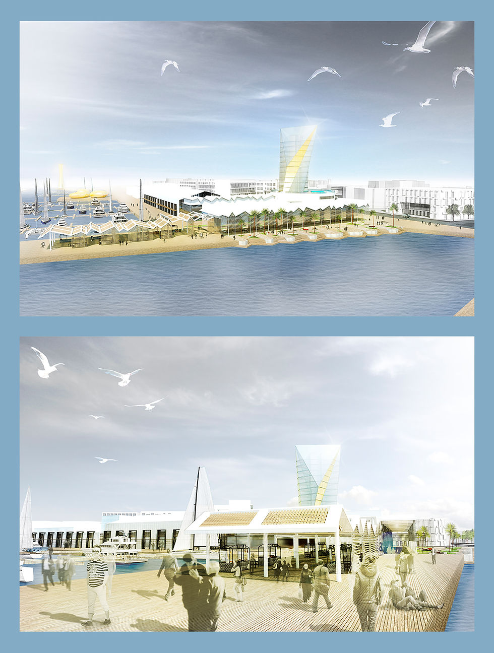
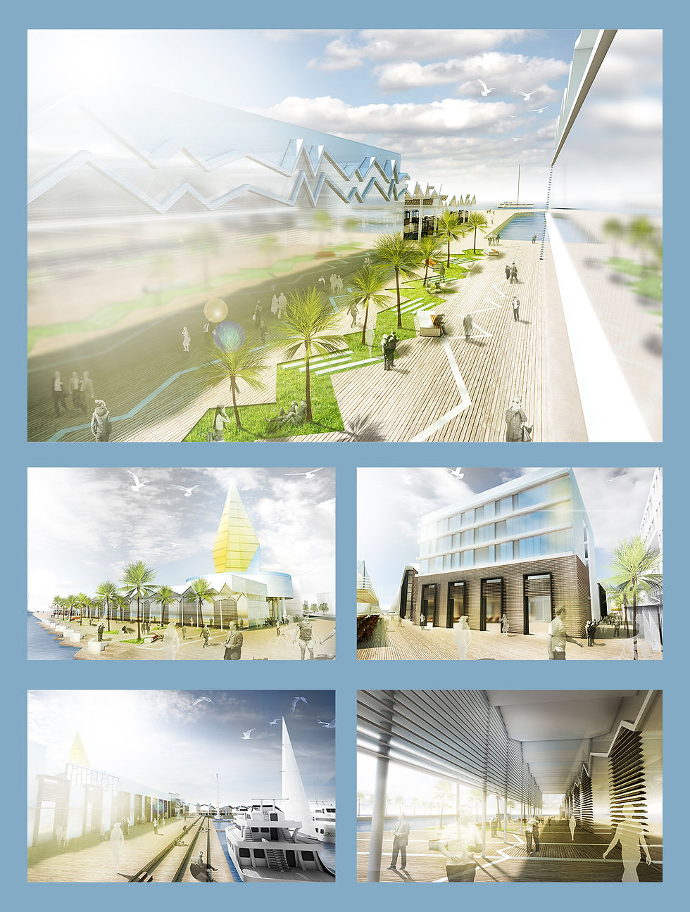
The project proposes strengthening and thickening the main transverse axis, Ga'aton River, by an urban marina.
Planning the Marina is affected by additional transverse streets that are parallel to Ga'aton Boulevard, combining them in the purpose to create an urban-center within the street's structure.
land-city
sea-land
Nahariya